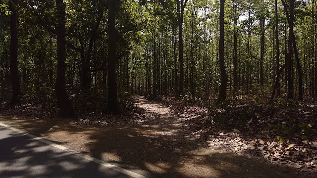
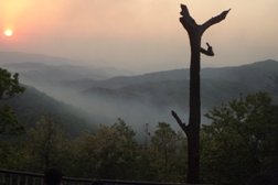
Netarhat being an untouched hill station in the Latehar district of Jharkhand is famous for its wilderness, lush green beauty, sunrise-sunset points and natural waterfalls. Referred to as the “Queen of Chotanagpur”, it is a popular hill station. Tourists from all over India and abroad visit Netarhat, whose name means Nature's, Heart. However, the place may have got its name from 'Netur Haat' (which means a marketplace for bamboo in the local language). It is at a height of 3622 feet above the sea level and is famous for picturesque landscape, scenic beauty and serene surroundings. The climate is pleasant here with the cool refreshing breeze and the breathtaking view of sunrise and sunset adds to the grandeur.
This place is also famous for Netarhat Residential School, as a centre of educational excellence.

Residential school

Netarhat has several places of tourist interests including
Magnolia Point (10 km from Netarhat, ideal site for viewing sunset),
Upper Ghaghri Falls (4 km from Netarhat),
Lower Ghaghri Falls (10 km from Netarhat),
Koel View Point (3 km from Netarhat),
Lodh Falls (60 km from Netarhat, the highest waterfall in Jharkhand),
Sadni Falls (35 km from Netarhat).
 |
| Ghagri falls |
MAGNOLIA POINT / SUNSET POINT:

sunset point

sunset point


"The Magnolia Sunset Point is an epitome of eternal love and sacrifice. The legends say that Magnolia, a British maiden, jumped off along with her horse, into the unfathomable depths of this valley, after failing to unite with her beloved, a local shepherd. The sight of setting Sun presents a breathtaking view from here."
How to Reach:
By Air: The nearest airport, Ranchi, is connected by daily flights to all major Indian cities. Patna airport is around 250 road-km from Betla. Most resorts have pick-ups facilities. Jharkhand Tourism also arranges pick-ups on advance notice.
By Rail: The nearest railway station is at Barwadih Junction; it's 122 km by taxi or bus. The station features connections from Daltonganj, Latehar, Ranchi, Sasaram, Gaya, Patna, Varanasi, Allahabad, Kolkata, Bhopal, Delhi and Amritsar.
By Road: It is 210 kilometres (130 mi) from Daltonganj or 156 kilometres (97 mi) west of Ranchi. It's about 2-3 hour drive from Ranchi, the state capital.
Where to stay:
The accommodation facilities in the tourist complex include a three-star hotel, the palamau forest rest bunglows, various tourist lodges with canteen, log huts and tree houses inside the forest with fully furnished suites. Jharkhand tourist Prabhat Vihar is by far the most popular, well-maintained accommodation that provides the best sunrise point as well.


No comments:
Post a Comment